


Buy anything from 5,000+ international stores. One checkout price. No surprise fees. Join 2M+ shoppers on Desertcart.
Desertcart purchases this item on your behalf and handles shipping, customs, and support to Italy.
🛰️ Never lose signal, never lose your edge.
The Garmin inReach Messenger is a compact, rugged handheld satellite communicator designed for professionals and adventurers who demand reliable global connectivity. Featuring interactive SOS alerts, real-time location sharing, and an impressive battery life of up to 50 hours, it ensures you stay connected and safe even in the most remote locations.
| ASIN | B0BGM2Q9QP |
| Are Batteries Included? | Yes |
| Audio Output Mode | Digital |
| Battery Average Life | 672 Hours |
| Best Sellers Rank | 534,320 in Fashion ( See Top 100 in Fashion ) 464 in Messenger Bags |
| Box Contents | Garmin InReach Messenger |
| Brand Name | Garmin |
| Compatible Devices | Smartphone |
| Compatible with Vehicle Type | Bicycle |
| Connectivity Protocol | Bluetooth |
| Control Method | Touch |
| Customer Reviews | 3.5 3.5 out of 5 stars (21) |
| Display Type | touch screen |
| Global Trade Identification Number | 00753759292362 |
| Human Interface Types | Buttons |
| Item Dimensions L x W x H | 6.4L x 2.3W x 7.8H centimetres |
| Item Type Name | Satellite Communication |
| Item Weight | 113.9 Grams |
| Manufacturer | Garmin |
| Manufacturer Part Number | 010-02672-01 |
| Map Coverage Type | Satellite |
| Model Name | Garmin inReach Messenger Satelliten-Kommunikationsgerät Wandern GPS |
| Model Number | 010-02672-01 |
| Model Year | 2022 |
| Mounting Type | Handlebar Mount |
| Network Connectivity Technology | Bluetooth |
| Operating Systems | Système d'exploitation embarqué propriétaire Garmin |
| Product Features | Ausdauernd |
| Screen Size | 0.43 Inches |
| Sport Type | Training |
| Supported Satellite Navigation System | Galileo |
| Touch Screen Type | Capacitive |
| UPC | 753759292362 |
| Unit Count | 1.0 count |
J**O
Wind speed misleading, accurate for minimum
Why 3 stars. The weather download is misleading for the most important thing on a hike: wind speed. On the app & the device itself the windspeed is only accurate for minimum. Temperature & wind chill are accurate Snow prediction ok So what I do is if wind speed is 30 mph I multiply by 2 to 2.5 to have an idea of how dangerous it is out there & that puts it in line with other mountain weather apps like Meteoblue
U**C
You pay every message over satelite. Outging and incoming.
R**2
Perfect little thing to have if you are a solo hiker, or if you hiker with someone else. You never know what could happen out there.
S**.
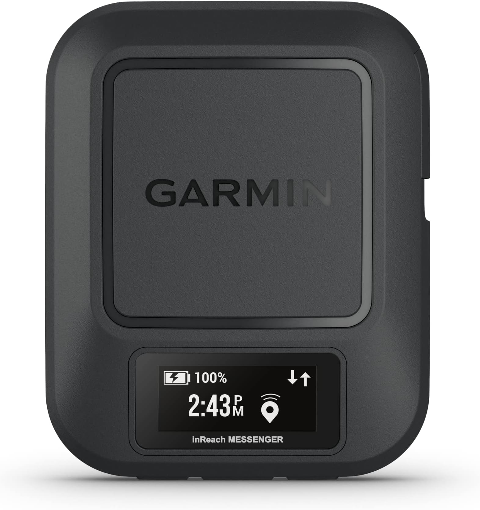
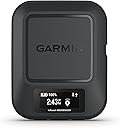
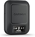
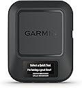
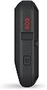
Dovendomi recare in luoghi privi di copertura satellitare, per motivi di sicurezza, mi sono convinto ad acquistare questo comunicatore satellitare della Garmin. Anche essendo possibile unicamente la comunicazione di testo (non voce) tramite SMS o EMAIL, questo device consente di avere un minimo base di connettività col mondo, capace anche di inviare un segnale di SOS di emergenza trasmettendo le coordinate del posto in cui vi trovate. Basandosi sulla rete IRIDUIM, consente di connettersi praticamente da qualsiasi punto del globo, oceani e poli compresi, contrariamente a quanto avviene con dispositivi più economici che si basano su satelliti geostazionari, che hanno una copertura più limitata, soprattutto se non si è in spazi aperti da dove si riesce a "vedere" il satellite che copre la zona in cui ci si trova. Trovo che nel complesso sia una soluzione ragionevole, senza dover ricorrere ai telefoni satellitari veri e propri con costi di gestione decisamente più elevati: il canone più economico prevede 40 euro annui a cui si aggiungono 20 euro per ogni mese di utilizzo.
C**N
La batería tiene una CAPACIDAD REAL DEMASIADO BAJA y SE DESCARGA del 100% al 36% en UN MES con el dispositivo TOTALMENTE APAGADO durante ese período. Un PELIGRO EN UN DISPOSITIVO al que uno confía su SEGURIDAD. ACONSEJO RECARGAR CADA QUINCE DÍAS AUNQUE NO SE USE EN ABSOLUTO y, por supuesto, cada vez que se usase. Y llevar un BANCO DE CARGA EN LA MOCHILA... Igualmente ACONSEJO LLEVAR un BANCO DE ENERGÍA PARA RECARGAR durante la excursión /travesía. Habida cuenta de cómo se descarga SIN USARLO, no quiero ni pensar en que lo necesite para una emergencia y no tenga cerca un banco de carga para mantenerlo operativo unas cuantas horas usándolo... La ironía es que Garmin presume de que el dispositivo puede ceder carga a otro... si la tuviera, claro. Como usuario me quejaba de las deficiencias de Garmin (siempre en sus productos tope de gama) ya hace más de quince años y lamentablemente tengo que seguir quejándome. Edito tras conversación hoy con el servicio de asistencia técnica de Garmin. Me ofrecen verificar el dispositivo pero lo peor es que me dicen que no les sorprende esa caída de batería en UN MES APAGADO. Aducen que el dispositivo lleva un hardware y un software que aún apagado consume energía (¡como si otros dispositivos como teléfonos móviles o relojes inteligentes no los llevasen!).Y me aconsejan mantener la carga al 50% cuando va a estar apagado! (consejo básico para cualquier batería de iones Li que vaya a estar en reposo períodos prolongado, pero eso nada tiene que ver con salidas prolongadas en montaña). Pero lo peor es que en su propia página web ellos presumen de hasta UN AÑO de duración de su batería SI APAGADO (véase captura de pantalla). Claro, "hasta"... Pero desde luego resulta publicidad engañosa.
A**K
Fortunately I have not had to use it for emergency. Be sure to buy an insurance if you go out. Else you will have to pay for the rescue yourself. Garmin launched it as a device where you pay for your use. Now they remade their subscriptions basically to enforce you to always pay, every month. And if you don't, you'll have to pay the activation fee again. If I knew they would have changed this I would have bought another device. That said, ensure not to trigger too many events, else battery drains faster.
Trustpilot
4 days ago
2 weeks ago